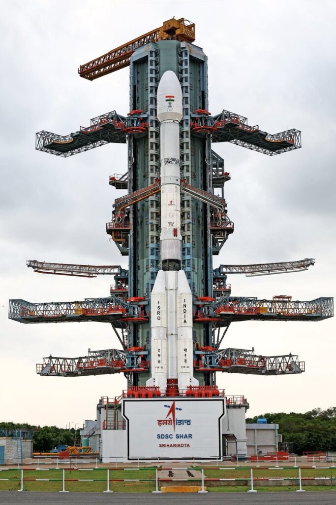
Sriharikota, July 30, 2025 — In a moment of global anticipation, India is all set to launch the NASA-ISRO Synthetic Aperture Radar (NISAR) satellite aboard GSLV-F16 at 17:40 IST today from the Satish Dhawan Space Centre in Sriharikota.

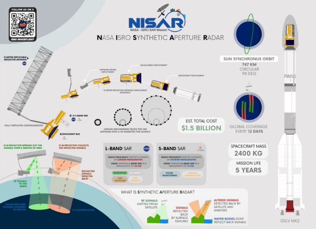
The mission marks a historic collaboration between the Indian Space Research Organisation (ISRO) and NASA, capping off over a decade of joint development. NISAR is now the world’s most advanced Earth observation satellite, and at an estimated cost of $1.5 billion, it is the most expensive Earth science payload ever launched by India.
What Is NISAR & Why It Matters?
NISAR is engineered to detect minute changes (as small as a few millimeters) in the Earth’s surface using a unique combination of L-band and S-band Synthetic Aperture Radars. This radar configuration allows it to monitor Earth’s dynamic systems, including:
Earthquakes & tectonic shifts Volcano activity Ice sheet movement & melting Landslides & soil instability Forest degradation & ecosystem changes
What sets NISAR apart is its all-weather capability—able to observe through clouds, night or day, with extreme precision, regardless of environmental conditions.
Launch Highlights
Launch Vehicle: GSLV-F16 Launch Time: 17:40 IST, July 30, 2025 Launch Site: Sriharikota, India Mission Cost: $1.5 Billion (Most expensive ISRO payload ever) Partners: ISRO 🇮🇳 & NASA 🇺🇸
Key Technical Features
L-Band Radar (developed by NASA) penetrates deeper into vegetation, soil, and ice. S-Band Radar (developed by ISRO) complements surface-level observation. Mounted on a 6000 kg satellite platform with an expected operational life of 3–5 years. Data will be made open-source, benefitting global researchers, climate scientists, and disaster planners.

Also Read : https://skylinktimes.in/how-india-beat-tech-denial-cryogenic-engine-powers-nisar-launch/
Why It’s a Game Changer
The launch of NISAR is a major milestone for Earth science and strategic collaboration between the US and India. Its data will enhance:
Climate change modeling Agricultural planning Urban development monitoring Natural disaster early warnings
It’s not just a satellite—it’s a precision scientific tool that will help humanity better understand and respond to environmental changes.
For More Post : Please stay tuned at https://skylinktimes.in/


